Authorities across the UK currently pay out over £30 million in compensation every year due to poor road conditions. This means that it is in the authorities best interest to identify and fix potholes as soon as possible. myPothole Detector addresses the problem of quickly identifying and logging potholes meaning local authorities can fix these potholes as soon as possible.
Description
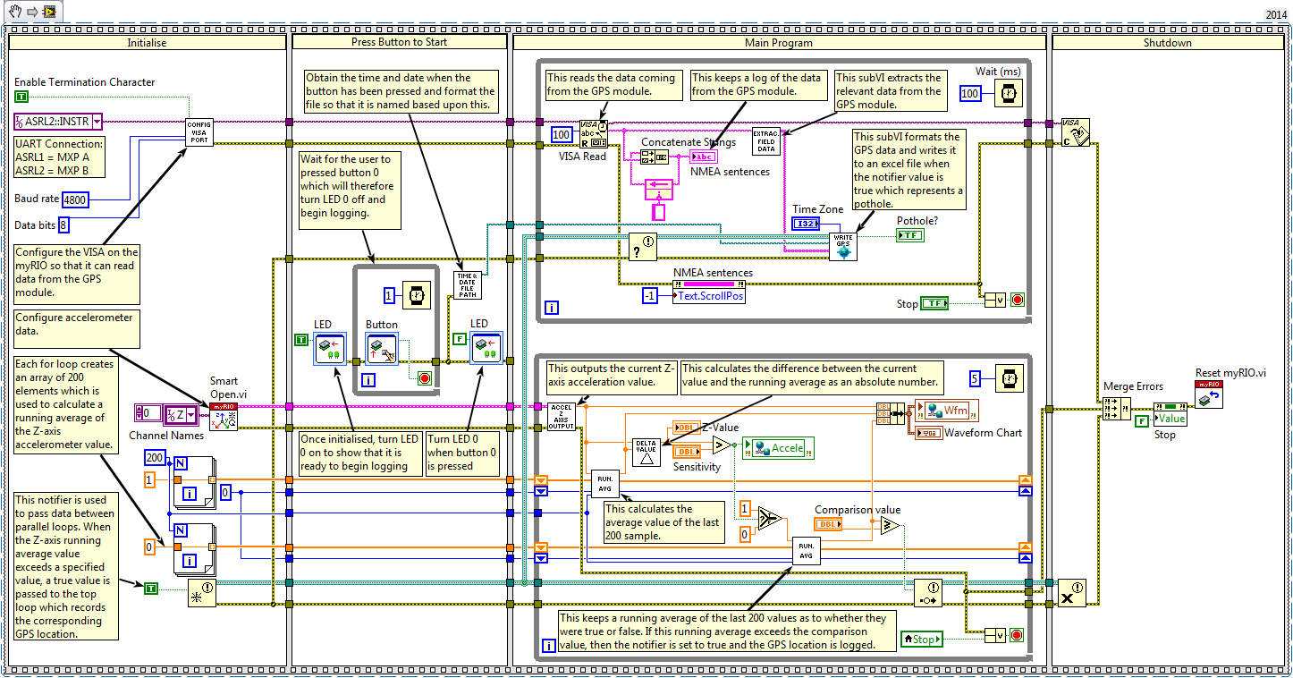
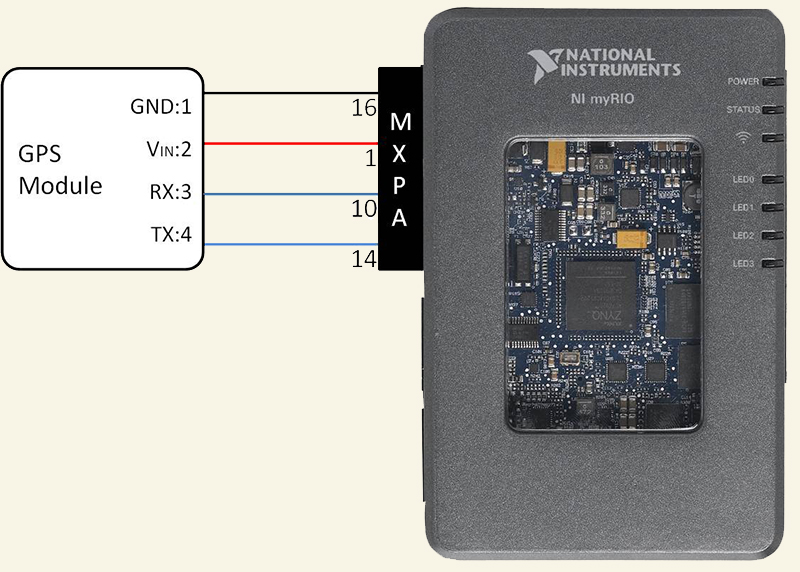
myPothole Detector harnesses the power of the myRIO using the built in accelerometer which determines whether a pothole has been detected using the the z-axis acceleration and signal processing. A GPS module is connected to the myRIO via the serial port and logs the current location when a pothole is detected.
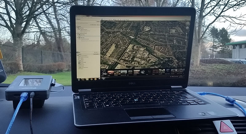
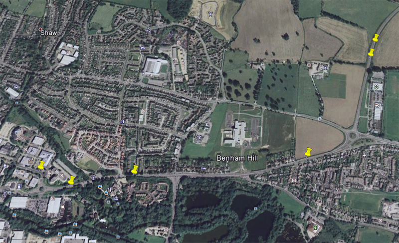
By connecting the myRIO to a PC with Google Earth installed, potholes can be plotted live onto the map. This makes it easier for the authorities to quickly see which areas are affected the most and can prioritise the fixing schedule based upon this.
Steps to Implement or Execute Code
Connect the myRIO to a PC via USB.
Power the myRIO either by connecting the power supply that comes with the myRIO or using an external battery.
On the PC, open 'Main.VI' found under the myRIO and make sure that you have the correct port selected. This will be dependent on what port you have used to connect the GPS module to.
Run the 'Main.VI' which will automatically deploy to the myRIO.
Run the 'Mission Control.VI' on the host computer.
When the myRIO is ready to begin logging data, 'LED 0' on the myRIO will light. To begin logging, press 'Button 0' which will begin the acquisition. 'LED 0' will turn off when it starts.
When the accelerometer detects a pothole, a marker will be placed on Google Earth and the position will also be logged in a data file stored on the myRIO.
My name is Sean Fuller and I am currently on a one year internship at National Instruments. I study BEng (Hons) Electronic Engineering at the University of Portsmouth and on my return, I plan to incorporate LabVIEW in my final year project.
Publications
This project has been featured in the following publications: